The Current Situation with Areas to be Rezoned
These two maps are the ones included in the Zoning Amendment Request.
Exhibit A shows the areas to be rezoned. Explanatory labels have been added for clarity.
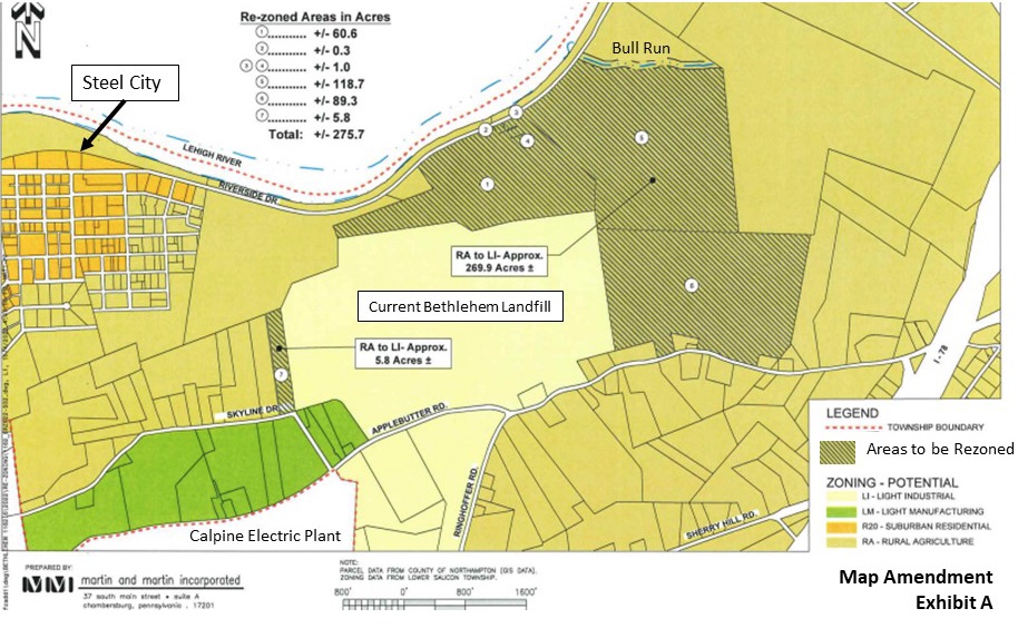
The light yellow area in the center of the map shows the current Bethlehem Landfill.
The cross-hatched areas in the map show the areas proposed to be rezoned.
The gold areas show properties that are zoned rural agriculture. Some of them are owned by Bethlehem Landfill and some are privately owned.
The orange areas show suburban residential zoned properties within Steel City and are not part of the proposed rezoning.
The green area shows properties that are zoned light manufacturing and are not part of the proposed rezoning.
Exhibit B shows the zoning as it will be upon final adoption.
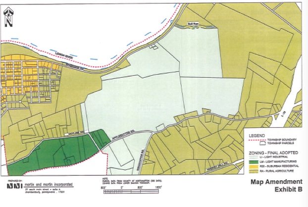
The light green area shows the entire area rezoned as light industrial that would be available to Bethlehem Landfill.
The Deceptive “Conservation” Map
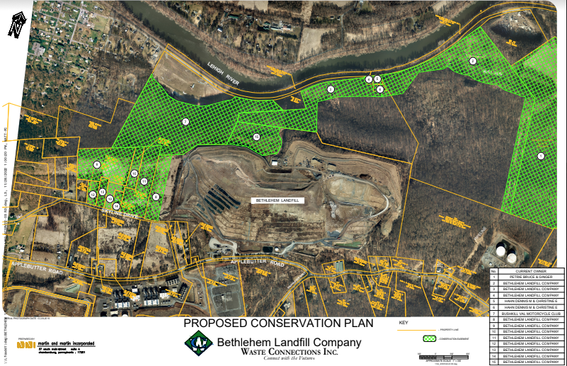
Bethlehem Landfill has provided this map – available on the township website at this link – purporting to show the land that they are proposing to put under a conservation easement. However, if you look carefully, you’ll see that the cross-hatched area in green with the #1 marking is actually private property owned by the Petries. It is NOT part of the “proposed conservation plan.” Despite several requests to their attorney, Bethlehem Landfill has refused to revise the map to remove this deception.
The remainder of the green cross-hatched area is owned either by Bethlehem Landfill Company or by the Hahns or the Bushkill Valley Motorcycle Club which the Landfill has represented as having agreed to enter into the conservation plan along with the Landfill Company.